Severe weather in the Midwest can escalate within minutes. When atmospheric instability sweeps across the Upper Mississippi Valley and clashes with warm, humid air masses over Lake Michigan, the National Weather Service (NWS) issues high-priority alerts to protect lives and property. Whether you are navigating your daily commute along I-94, attending an outdoor game in the metro area, or relaxing at home, understanding Wisconsin tornado warnings and localized alert mechanisms is critical.
This comprehensive guide delivers verified meteorological context, actionable shelter steps, differences between alerts, and specific safety protocols for navigating severe weather across Milwaukee and surrounding Wisconsin communities.
Understanding Wisconsin Severe Weather: Watches vs. Warnings
When tracking volatile weather Milwaukee conditions or statewide weather systems, confusion often arises around National Weather Service terminology. Recognizing the distinction between watches, warnings, and emergencies ensures you react with the right level of urgency.
       [ CONVECTIVE OUTLOOK / MARGINAL RISK ]
                         │
                         ▼
             [ SEVERE WEATHER WATCH ]
           (Conditions Favorable -> PREPARE)
                         │
                         ▼
            [ SEVERE WEATHER WARNING ]
            (Imminent Danger -> ACT NOW)
                         │
                         ▼
            [ TORNADO EMERGENCY ]
      (Catastrophic Threat Confirmed -> SURVIVE)
Severe Thunderstorm Watch vs. Warning
- Severe Thunderstorm Watch: Atmospheric conditions are favorable for the development of severe storms capable of producing damaging winds of 58 mph or higher and quarter-sized hail (1 inch in diameter) or larger. A watch covers large geographic areas and serves as an advance notice to review safety plans.
- Severe Thunderstorm Warning: A severe thunderstorm has been detected by Doppler radar or confirmed by trained storm spotters. Imminent danger exists for localized wind damage, falling trees, power outages, and large hail.
Tornado Watch vs. Tornado Warning
- Tornado Watch: Supercell thunderstorms in the area have the potential to produce rotation and tornadoes. During a watch, you should monitor local broadcasts, charge mobile devices, and ensure your shelter space is clear and accessible.
- Tornado Warning: A tornado has been sighted by storm spotters or indicated by Doppler radar rotation. If a tornado warning Milwaukee alert or countywide warning is triggered, danger to life and property is immediate. Seek underground or interior shelter immediately.
What Is a Tornado Emergency?
A Tornado Emergency is the highest alert level issued by the NWS. It signifies that a confirmed, violent, and catastrophic tornado is on the ground and approaching a populated area. Immediate protective action is required to survive.

Alert Comparison: What Each Weather Notice Means
| Alert Level | Meaning | Danger Level | Recommended Action |
| Marginal / Slight Risk | Isolated strong to severe storms possible | Low to Moderate | Monitor local radar updates throughout the day. |
| Severe Thunderstorm Watch | Storm development possible across the region | Moderate | Review emergency kits; secure outdoor furniture. |
| Severe Thunderstorm Warning | High winds (≥58 mph) or large hail detected | High | Move indoors away from windows and glass doors. |
| Tornado Watch | Conditions favor rotating supercells and tornadoes | High | Ready your shelter; keep emergency radios on. |
| Tornado Warning | Funnel cloud or tornado confirmed/radar-indicated | Extreme | Move to a basement or interior room immediately. |
| Tornado Emergency | Violent, life-threatening tornado on the ground | Catastrophic | Take ultimate underground or reinforced shelter. |
Recent Storm Patterns in Southern & Southeastern Wisconsin
Southern Wisconsin frequently experiences fast-moving convective weather systems. Cold fronts advancing from the northwest collide with humid surface moisture, generating squall lines and discrete supercells.
During late summer and transitional seasons, the NWS Forecast Office in Milwaukee/Sullivan frequently tracks storms crossing south-central counties—such as Sauk, Columbia, Dane, and Dodge—before racing eastward into the Greater Milwaukee metropolitan area and Lake Michigan shoreline.
  [ Cold Front Inflow ] ---> [ Central WI (Sauk / Columbia) ]
                                      │
                                      ▼
                             [ Southern Corridor ]
                                      │
                                      ▼
                        [ Metro Milwaukee / Lakeshore ]
                         (Waukesha, Ozaukee, Racine)
Common Hazards Associated with Wisconsin Severe Fronts
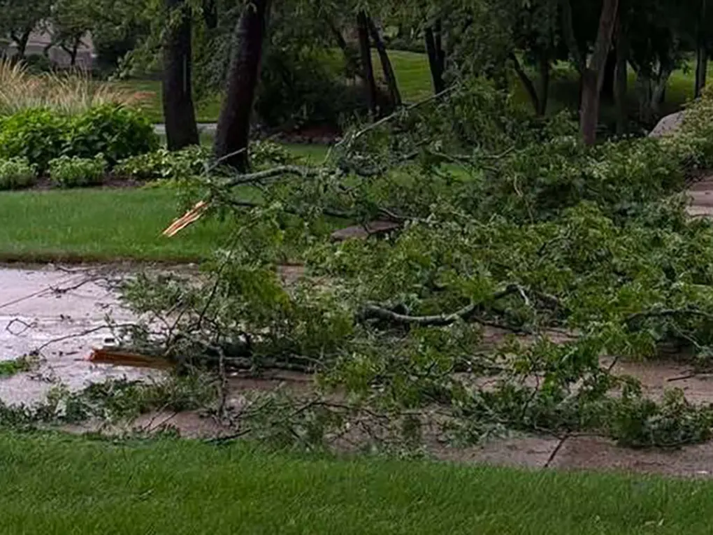
- Straight-Line Winds: Convective downdrafts (microbursts and macrobursts) can exceed 70 mph, downing utility lines and uprooting mature trees.
- Flash Flooding: Heavy precipitation rates exceeding 1 to 2 inches per hour overwhelm municipal drainage systems and low-lying roads.
- Large Hail: Updrafts inside intense cells suspend freezing moisture, producing hail capable of damaging vehicles, siding, and roofs.
- Isolated Tornadoes: While widespread outbreaks remain rare, squall line circulations (QLCS tornadoes) and isolated supercell funnels can spin up rapidly with minimal lead time.
Is Milwaukee at Risk for Tornadoes?
A common misconception is that the proximity of Lake Michigan provides a “shield” against severe weather. While the cool lake breeze (often called the “lake effect” or marine boundary) can occasionally stabilize the immediate lakeshore air, it can also create localized boundary zones that enhance low-level wind shear and storm rotation.
The Urban Myth of Lake Protection
Tornadoes and severe thunderstorms have historically moved across Milwaukee County and adjacent lakeshore communities. A tornado Milwaukee event remains an active meteorological possibility whenever strong frontal boundaries push across the state. Relying on geographical myths during active Wisconsin tornado warnings puts households at serious risk.
Vulnerability of High-Density Metro Areas
- Flying Debris: High-density construction and commercial corridors increase the volume of hazardous airborne debris during high winds.
- Commuter Traffic: Interstates such as I-94, I-43, and I-41 experience dense traffic during afternoon rush hours, leaving motorists vulnerable if storms strike during peak transit times.
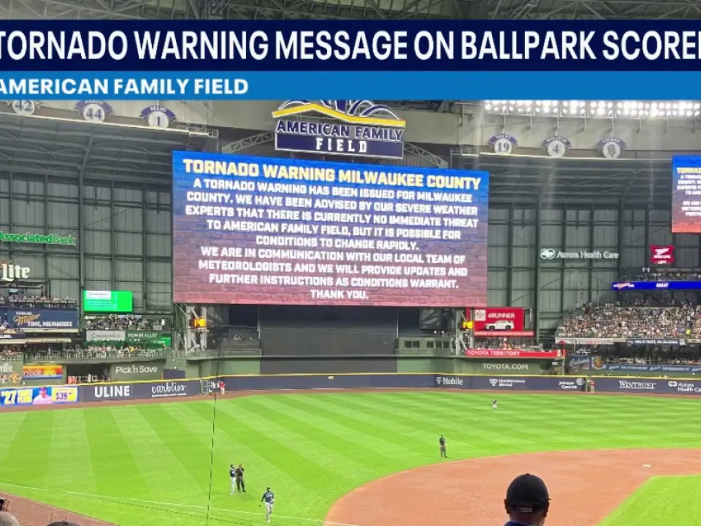
- Event Venues: Venues like American Family Field, lakefront festivals, and county parks require rapid shelter coordination when alerts sound.
How to Receive Verified Weather Alerts in Real Time
When a milwaukee tornado warning is issued, seconds count. Multiple redundant alert channels ensure you receive critical notices even if regional power grids or cellular networks experience disruptions.
       ┌───────────────────────────────┐
       │   NWS Milwaukee/Sullivan      │
       └──────────────┬────────────────┘
                      │
     ┌────────────────┼────────────────┐
     ▼                ▼                ▼
[ NOAA Radio ]   [ WEA Alerts ]   [ Local Broadcasts ]
(Continuous)     (Smartphones)     (TMJ4, FOX6, WISN, CBS58)
NOAA Weather Radio (NWR)
An all-hazards NOAA Weather Radio with Specific Area Message Encoding (SAME) technology is the gold standard for home safety. It broadcasts alerts 24/7 directly from NWS broadcast stations (such as station KEC60 in Milwaukee on 162.400 MHz), sounding an audible alarm even while you are asleep.
Wireless Emergency Alerts (WEA)
Modern cellular smartphones automatically receive WEA geographic notifications during life-threatening events. Ensure that your mobile settings allow “Emergency Alerts” and “Extreme Threat Alerts.”
Local Broadcast Media & Digital Feeds
Milwaukee’s meteorology teams provide continuous live radar streaming, storm tracking, and street-level projections:
- Local news affiliates (FOX6 Milwaukee, WTMJ-4, WISN 12, CBS 58)
- The National Weather Service Milwaukee/Sullivan forecast office website (weather.gov/mkx)
Outdoor Warning Sirens
Outdoor sirens are designed strictly to warn people outdoors to seek indoor shelter immediately. They are not intended to be heard clearly inside modern, insulated homes or over the sound of air conditioners and televisions. Never rely exclusively on outdoor sirens for home notification.
Immediate Action Steps: What to Do During a Tornado Warning
When radar indicates circulation or a spotter confirms a milwaukee tornado, execute your emergency plan without hesitation.
              ┌───────────────────────────────┐
              │    TORNADO WARNING ISSUED     │
              └──────────────┬────────────────┘
                             │
            ┌────────────────┴────────────────┐
            ▼                                 ▼
      [ At Home / Office ]               [ In a Vehicle ]
            │                                 │
     ┌──────┴──────┐                   ┌──────┴──────┐
     ▼             ▼                   ▼             ▼
[ Basement ] [ Interior Room ]   [ Find Structure ] [ Low Ditch ]
(Lowest level) (Put walls between) (Never under overpass) (Cover head)
If You Are in a Single-Family Home
- Move to the Lowest Level: Go to the basement or storm cellar immediately.
- Get Under Sturdy Protection: Position yourself under a heavy workbench, reinforced table, or beneath the stairs.
- Interior Rooms (No Basement): If your home lacks a basement, seek refuge in an interior room on the lowest floor, such as a center hallway, closet, or bathroom.
- Put Walls Between You and the Storm: Exterior walls, windows, and patio doors are the most fragile points of a house.
- Protect Your Head: Wear a bicycle helmet, sports helmet, or use thick blankets and pillows to guard against blunt-force head trauma from flying debris.
If You Are in an Apartment or Multi-Story Complex
- Never use elevators during a severe storm, as power outages can leave you trapped between floors.
- Descend to the ground floor or basement parking garage common area if accessible.
- If descending is impossible, move to an interior hallway or bathroom away from all exterior windows and balconies.
If You Are Driving or in a Vehicle
- Do Not Try to Outrun a Tornado: Tornadoes can shift direction erratically and travel across the ground at speeds exceeding 60 mph.
- Seek Substantial Shelter: Exit the highway and pull into a sturdy, permanent commercial building or gas station facility.
- Never Shelter Under Highway Overpasses: Overpasses act as wind tunnels, accelerating air velocities and funneling debris directly through the narrow corridor.
- Last Resort in Open Terrain: If caught in open country with no available shelter, park your vehicle outside traffic lanes, keep your seatbelt fastened, duck down below window level, and cover your head with a coat or blanket. Alternatively, lie flat in a low ditch face down, shielding the back of your head and neck.
If You Are in a Mobile Home or Prefabricated Structure
- Evacuate immediately. Mobile homes offer minimal protection against tornado-force winds, even when anchored.
- Relocate to a designated community storm shelter or nearby permanent structure well before severe weather arrives.
Essential Severe Weather Emergency Kit Checklist
Preparing an emergency kit ensures resilience following severe storms, power disruptions, or infrastructure damage. Keep these items gathered in a dedicated, portable container inside your designated shelter area.
+--------------------------------------------------------------+
|             WISCONSIN EMERGENCY DISASTER KIT                |
+--------------------------------------------------------------+
|  [X] Water (1 gallon per person/day for 3 days)              |
|  [X] Non-perishable food & manual can opener                 |
|  [X] Battery-powered or hand-crank NOAA radio                |
|  [X] LED flashlights + extra battery reserves                |
|  [X] Comprehensive first aid supplies                        |
|  [X] Sturdy footwear (work boots) for post-storm debris      |
|  [X] Portable power bank for mobile phone charging           |
|  [X] Whistle to signal emergency rescue personnel            |
|  [X] Prescriptions, hygiene supplies, and pet essentials     |
|  [X] Protective headwear (helmets for all family members)    |
+--------------------------------------------------------------+
Post-Storm Safety & Recovery Protocols
The period immediately following a severe weather event carries secondary hazards. Exercise extreme caution when exiting your shelter area.
Watch for Downed Utility Lines
Treat every downed wire as an energized, live power line. Maintain at least a 35-foot perimeter and report downed lines immediately to We Energies (or your local utility provider) and emergency services.
Inspect for Structural and Gas Hazards
- If you smell natural gas (a rotten egg odor) or hear a hissing noise, evacuate your building immediately and contact the utility company from a safe location.
- Do not light matches, use lighters, or operate electrical switches until the structure has been cleared of gas leaks.
Clear Debris Safely
- Wear heavy leather work gloves, thick-soled work boots, and safety glasses when clearing tree limbs and broken glass.
- Avoid entering structurally compromised rooms until professional building inspectors have deemed them safe.
Frequently Asked Questions (FAQ)
What is the difference between a tornado watch and a tornado warning in Wisconsin?
A tornado watch means weather conditions over Wisconsin are favorable for the formation of tornadoes; you should stay alert and prepare your shelter. A tornado warning means a tornado has been spotted by trained spotters or detected by Doppler radar; you must take protective shelter immediately.
When is tornado season in Wisconsin?
While tornadoes can occur during any month if atmospheric conditions align, Wisconsin’s primary severe weather and tornado season peaks from May through August, with June experiencing the highest historical frequency of tornadic activity.
Where is the safest place to go during a Milwaukee tornado warning if I don’t have a basement?
If you do not have access to a basement, go to the lowest floor and locate a small, central interior room with no windows, such as a bathroom, hallway, or walk-in closet. Surround yourself with heavy blankets or mattresses and wear a helmet to protect against debris.
Why didn’t I hear the outdoor tornado sirens inside my home?
Outdoor warning sirens are installed solely to alert individuals who are outdoors to seek shelter. They are not engineered to penetrate the walls, roofs, and double-pane windows of modern residential structures. For reliable indoor alerts, rely on a NOAA Weather Radio and Wireless Emergency Alerts (WEA) on your smartphone.
Are tornados common in the Milwaukee metro area?
While Milwaukee County experiences fewer tornadoes on average than rural western and southern Wisconsin counties, severe storms and tornadoes do occur across the metro area. Lake Michigan does not prevent severe weather from producing damaging tornadic circulations.
Conclusion
Severe weather can develop rapidly across the Great Lakes region. Staying ahead of Wisconsin tornado warnings requires understanding meteorological terminology, establishing a proven home emergency plan, and maintaining active, redundant alert devices.